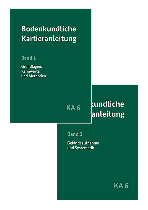
German Soil Survey Guidelines KA 6 - The binding guide to soil mapping and soil data collection in Germany - From July 30, 2024 / 6th completely revised and expanded edition
News from Jul 11, 2024
- The Earth Sciences Library has pre-ordered the brand new volumes of the Soil Science Mapping Guide. Link to the new 6th edition in PRIMO
- The Soil Survey Guidelines will be published on July 30, 2024 and is an absolute must for anyone involved in soil mapping and soil data.
- The previous Soil Survey Guidelines KA5 from 2005 can be found in the Earth Sciences Library via the following link in PRIMO
Content description:
[ Translated, book published in German ]The Soil Survey Guidelines is the binding guideline for soil mapping and the collection of soil data in Germany. Since the publication of the KA5 in 2005, the requirements for the Soil Survey Guidelines have changed considerably (among other things due to the Geological Data Act, the Mantel Ordinance and the revised Federal Soil Protection and Contaminated Sites Ordinance). The rapid development of information technology and digital data processing also enables the user-oriented evaluation of complex pedological information.
Existing data field-related key lists have been expanded and adapted to current data requirements. Additional information such as the form of appearance, degree of expression, proportion of area and size was added to the respective data fields and, where necessary, provided with more precise definitions in order to improve the completeness and thus the quality of the data collected. Pictograms mark the obligatory data fields for various recording purposes, including the pedological land survey and pedological construction monitoring. The chapters on soil mapping have been significantly expanded.
The definition of horizon symbols has been changed to diagnostic criteria. In order to avoid overlaps and gaps between the soil classification units, the soil classification has been changed from the specification of entire horizon sequences to the specification of diagnostic horizons, which now make it easier to classify a soil in the classification. Further changes and additions concern the introduction of new soil types, such as the andosol or the peatland soils resulting from degradation processes in the course of decades of use as "abmoor" subtypes of hydromorphic soils.
In order to facilitate the use of the substrate system, a more compact representation was chosen in addition to individual simplifications. This is intended to facilitate the recording and identification of particularly substrate-dominated soils, especially on residential, industrial and commercial sites.
A new feature is the possibility of describing humus horizons and the inclusion of humus forms in a separate classification system.
At the request of many users, the contents of KA6 have been unbundled. For practical reasons, KA6 is published in two volumes, a basic principles, parameters and methods volume on the one hand and a terrain volume with updated key lists for soil survey, soil and substrate systematics, explanation of the model of periglacial layers and humus form systematics on the other.
- Band 1: Grundlagen, Kennwerte und Methoden (Volume 1: Fundamentals, parameters and methods)
- Band 2: Geländeaufnahme und Systematik (Volume 2: Terrain survey and systematics)
For decades, the Soil Survey Guidelines has also been an essential basis for the soil information systems of the State Geological Services. It is intended to simplify the exchange of soil data between providers and users as well as between IT systems and to increase the availability and usefulness of this data. The tables for data evaluation, in particular for the soil water balance, have been completely revised on the basis of new data and triangular diagrams for estimating water balance parameters in the field have been added. The new mapping instructions were developed by the State Geological Services, the BGR and working groups of scientific societies (German Soil Science Society, Society for Peat and Bog Science).
Keywords
- [German Soil Survey Guidelines 6th completely revised and extended edition, KA6].
- Binding instructions
- Diagnostic criteria
- Digitization
- Federal Soil Protection Ordinance
- Geological Data Act
- Horizon symbols
- Humus horizons
- Information technology
- Key lists
- Quality
- Soil data
- Soil information systems
- Soil mapping
- Soil protection
- Soil protection
- Soil systematics
- Substrate systematics
- Triangular diagrams
- User-oriented
- Water balance
