Department of Earth Sciences
Service Navigation
Aganippe Fossa - Where Ice and Lava flow (03.07.2024)
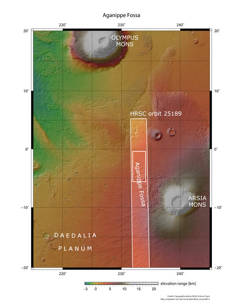
Image data, taken by the High Resolution Stereo Camera (HRSC) on board ESA’s Mars Express mission show the northern part of the Aganippe Fossa, located at the foot of the Arsia Mons volcano. HRSC is a camera experiment that was developed and is operated by the German Aerospace Center (Deutsches Zentrum für Luft- und Raumfahrt; DLR).
» read more in the main article below...
Aganippe Fossa • Position & 3D view
Aganippe Fossa - context map
Image Credit: MOLA Science Team/FU Berlin
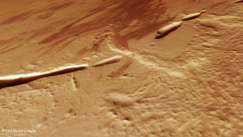
Aganippe Fossa - 3D
Image Credit: ESA/DLR/FU Berlin
Aganippe Fossa • HRSC images
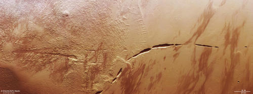
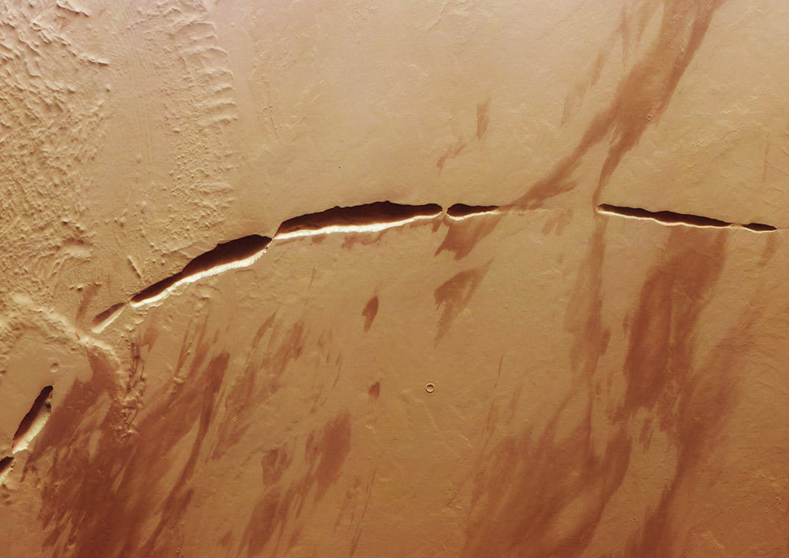
Aganippe Fossa - HRSC color image
Image Credit: ESA/DLR/FU Berlin
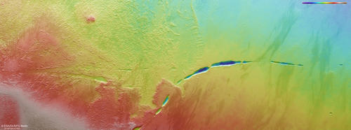
Aganippe Fossa- HRSC color-coded terrain model
Image Credit: ESA/DLR/FU Berlin
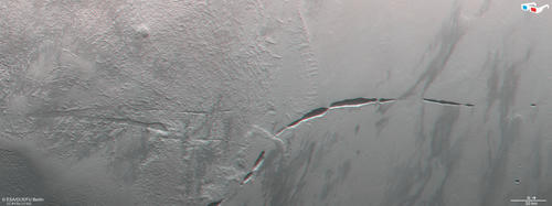
Aganippe Fossa - HRSC anaglyph
Image Credit: ESA/DLR/FU Berlin
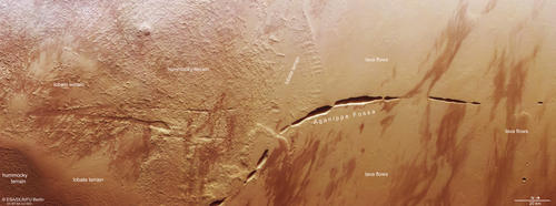
Aganippe Fossa - HRSC annotated image
Image Credit: ESA/DLR/FU Berlin
Aganippe Fossa
The image shows a portion of the lower flank of Arsia Mons with the aureole and a part of the large Aganippe Fossa tectonic graben structure. Dark, wind-blown dust/sand deposits create an interesting striated pattern and in the smooth regions of the image (northern/right section) many lava flows can be found at closer inspection.
Arsia Mons is a shield volcano and the southernmost of the three Tharsis Montes volcanos, located on the Tharsis bulge. The giant volcano measures 435 km in diameter and rises more than 9 km above the surrounding plains. It stands out from the other giant volcanic shields of Tharsis with its collapse caldera measuring 128 x 113 km, the largest on Mars. Arsia Mons also possesses a so-called “aureole”, an ice related flow feature and a common signature of the Tharsis Montes.
The Arsia Mons aureole covers more than 100,000 km2 and is developed only at the northwestern flank of the volcanic edifice. A reason for this could be that the prevailing NW winds generated an asymmetric ice ablation and the ice consequently accumulated only on the lee side of the volcano. Within the image, two main characteristic features of the aureole can be identified. A hummocky terrain, forming the central part of the structure and a lobate terrain, burying parts of the hummocky terrain.
The Aganippe Fossa shows a length of roughly 600 km and the bounding graben walls are 3 to 7 km apart. The formation of the Aganippe Fossae is discussed. Some scientists suggest that it represents an isolated member of the Thaumasia Fossae group, other interpretations suggest the late stage intrusive activity at Olympus Mons that formed the giant dikes in the region.
High Resolution Stereo Camera (HRSC)
The images were acquired by the HRSC (High Resolution Stereo Camera) on 13 December 2023 during Mars Express Orbits 25189. The ground resolution is approximately 25 meters per pixel and the image is centered at about 233° East and 3° South. The color image was created using data from the nadir channel, the field of view which is aligned perpendicular to the surface of Mars, and the color channels of the HRSC. The oblique perspective view was generated from the digital terrain model, the nadir and color channels of HRSC. The anaglyph image, which creates a three-dimensional impression of the landscape when viewed with red/blue or red/green glasses, was derived from the nadir channel and one stereo channel. The color-coded topographic view is based on a digital terrain model (DTM) of the region, from which the topography of the landscape can be derived. The reference body for the HRSC-DTM is a Mars equipotential surface (Areoid).
HRSC is a camera experiment that was developed and is operated by the German Aerospace Center (Deutsches Zentrum für Luft- und Raumfahrt; DLR). The systematic processing of the camera data took place at the DLR Institute for Planetary Research in Berlin-Adlershof. The working group of Planetary Science and Remote Sensing at Freie Universität Berlin used the data to create the image products shown here.
To download released raw images and DTMs of the region in GIS-ready formats, follow this link to the mapserver
Images: ESA/DLR/FU Berlin, CC BY-SA 3.0 IGO
Copyright Notice:
Where expressly stated, images are licenced under the Creative Commons Attribution-ShareAlike 3.0 IGO (CC BY-SA 3.0 IGO) licence. The user is allowed to reproduce, distribute, adapt, translate and publicly perform it, without explicit permission, provided that the content is accompanied by an acknowledgement that the source is credited as 'ESA/DLR/FU Berlin', a direct link to the licence text is provided and that it is clearly indicated if changes were made to the original content. Adaptation / translation / derivatives must be distributed under the same licence terms as this publication.
The High Resolution Stereo Camera was developed at the German Aerospace Center (DLR) and built in collaboration with partners in industry (EADS Astrium, Lewicki Microelectronic GmbH and Jena-Optronik GmbH). The science team, which is headed by Principal Investigator (PI) Dr. Daniela Tirsch, consists of 50 co-investigators from 35 institutions and 11 countries. The camera is operated by the DLR Institute of Planetary Research in Berlin-Adlershof.
