Department of Earth Sciences
Service Navigation
Caralis Chaos – At the Shores of Lake Eridania
Image data, taken by the High Resolution Stereo Camera (HRSC) on board ESA’s Mars Express mission show a scene from a region located between Terra Cimmeria and Terra Sirenum where a large lake once lay. HRSC is a camera experiment that was developed and is operated by the German Aerospace Center (Deutsches Zentrum für Luft- und Raumfahrt; DLR).
» read more in the main article below...
Caralis Chaos • Position & 3D view

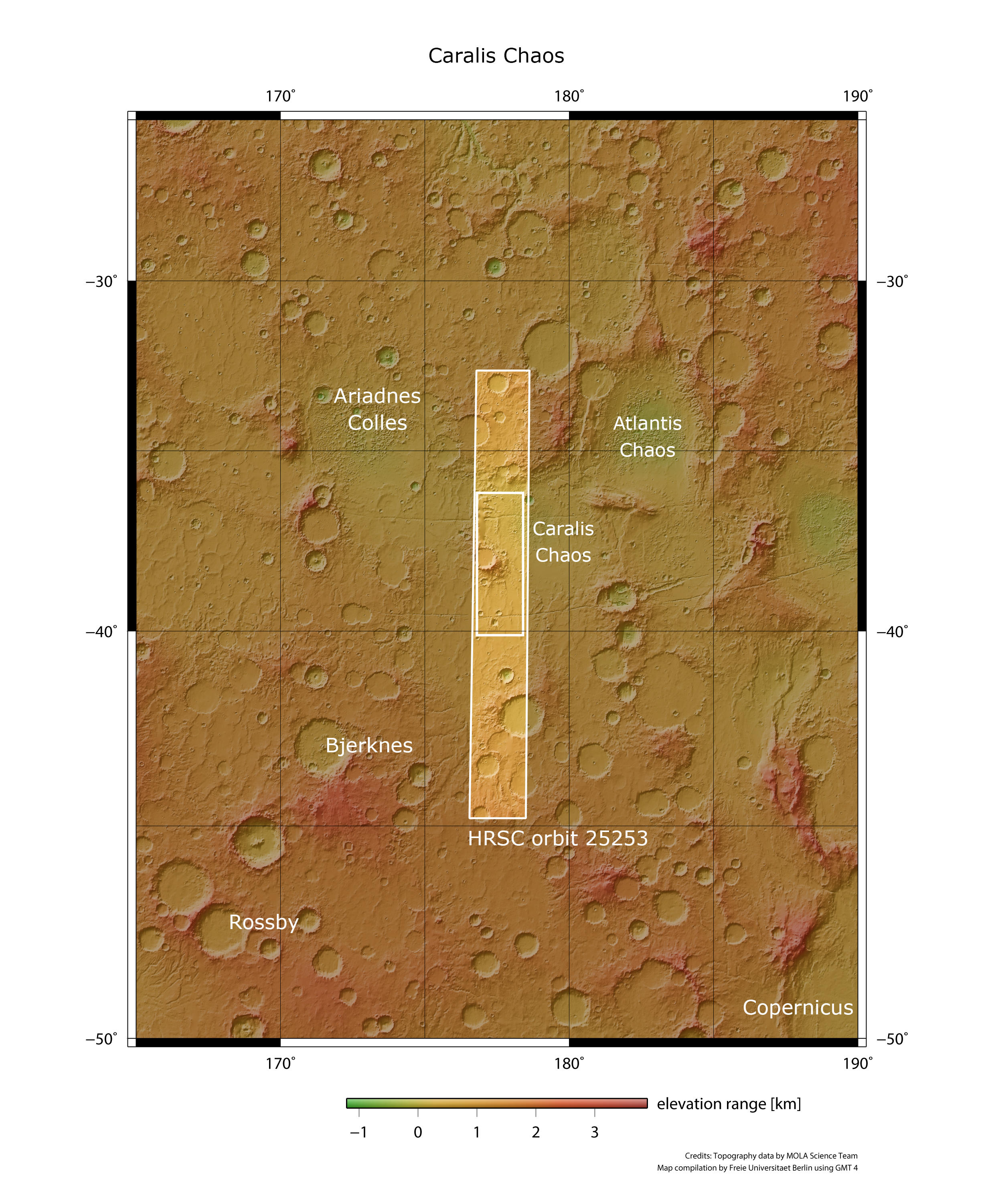
Caralis Chaos - context map
Image Credit: MOLA Science Team/FU Berlin

Caralis Chaos - 3D perspective 1
Image Credit: Image Credit: ESA/DLR/FU Berlin

Caralis Chaos - 3D perspective 2
Image Credit: Image Credit: ESA/DLR/FU Berlin
Caralis Chaos • HRSC images

Caralis Chaos - HRSC color image
Image Credit: Image Credit: ESA/DLR/FU Berlin

Caralis Chaos - HRSC color-coded terrain model
Image Credit: Image Credit: ESA/DLR/FU Berlin

Caralis Chaos - HRSC anaglyph
Image Credit: Image Credit: ESA/DLR/FU Berlin

Caralis Chaos - HRSC annotated image
Image Credit: Image Credit: ESA/DLR/FU Berlin
Caralis Chaos
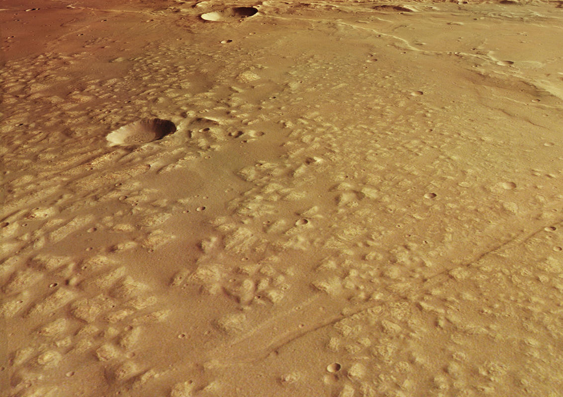
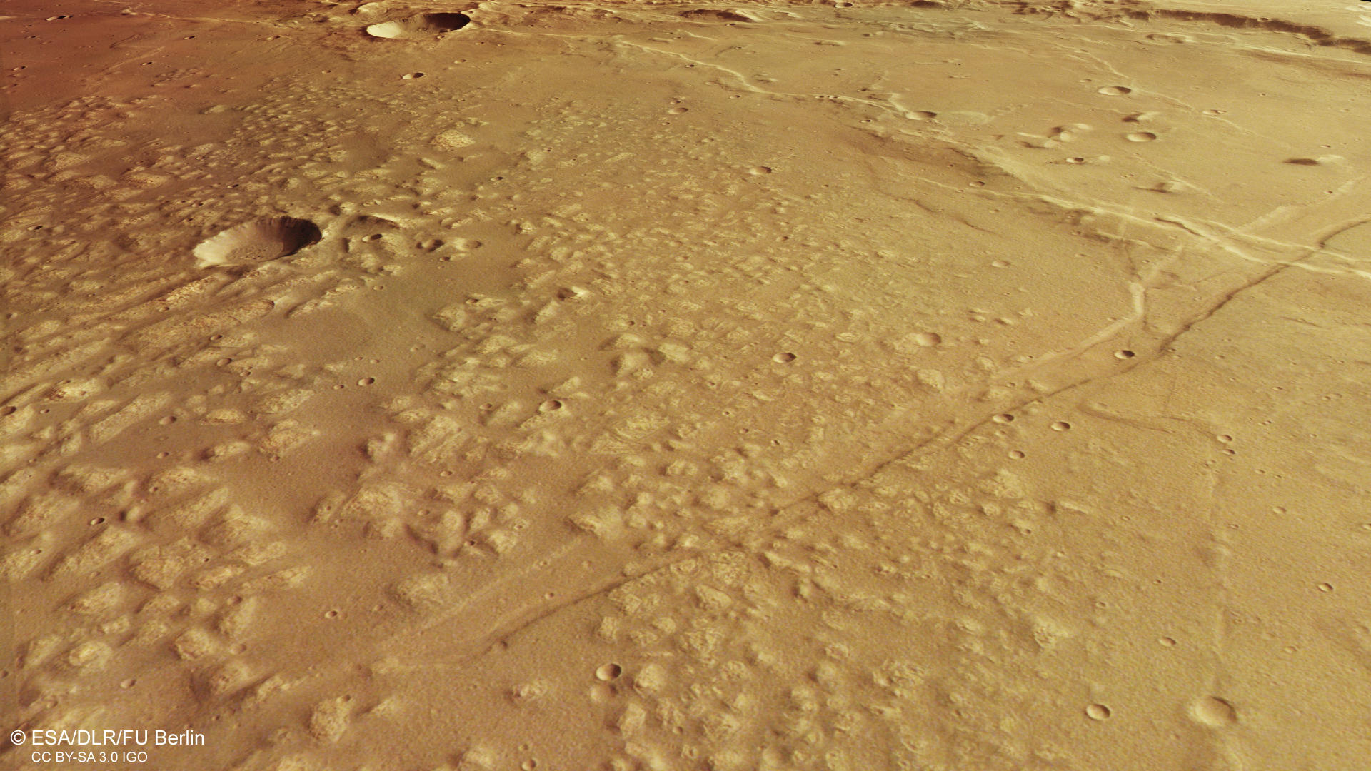
The region between Terra Cimmeria and Terra Sirenum features several enigmatic knob fields located in large degraded basins. These knob fields were first mapped on Viking imagery as chaotic terrain. However, they lack a direct link to an outflow channel and also show other differences to the chaotic terrains of the circum-Chryse region. Therefore, the terms knob field or knobby terrain are used despite their official names like for example Atlantis chaos further to the east, or Caralis Chaos presented here. These regions are believed to represent the remnants of the ancient Eridania lake. Spanning over roughly 1.1 million square kilometers and three large basins, lake Eridania may represent the source region of the large Ma’adim Vallis outflow channel further to the north. The Eridania lake is hypothesized to have existed during the Middle to Late Noachian period. Later in time, the large lake divided into smaller isolated lakes and eventually disappeared altogether along with the rest of the water on the planet.
The lower right side of the image shows a part of Caralis Chaos. As spectroscopic observations indicate, the knobby and light-toned material could represent an ancient airfall deposit that was later covered and altered by water. When the lakes dried out, the material broke up and wind erosion set in. Later in time, the Sirenum Fossae faults overprinted the landscape, crosscutting the knob field and the smooth surface on the left side of the image.
Very interesting is the high amount of wrinkle ridges in the region. Wrinkle ridges are common features on volcanic plains. They develop when the lava sheet is compressed and still slightly soft and elastic. The lava sheet buckles and deforms under the compressional stress triggered by the continuous pressure of the newly produced lava.
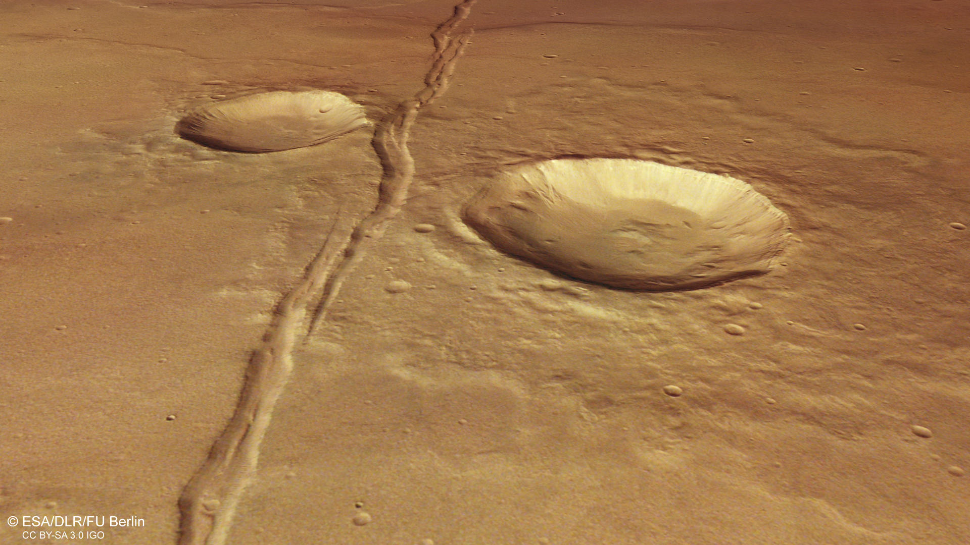
Another interesting observation can be made on the southern side of the large, flat-floored impact crater in the central portion of the image. Apparently, several flows and small valleys can be spotted here, presumably indicating the possible presence of water in a later episode. The smaller crater to the south shows small gullies on its northern flank, which seem to have eaten away parts of the crater infill at the bottom. Small valleys can also be spotted at closer inspection in many places outside of the crater, draining into the basin. On the upper right side of the image lies a dissected plateau with a smooth surface. Here, the remnants of several, heavily eroded impact craters can be found.
High Resolution Stereo Camera (HRSC)
The images were acquired by the HRSC (High Resolution Stereo Camera) on 1 January 2024 during Mars Express Orbit 25253. The ground resolution is approximately 15 meter per pixel and the image is centered at about 177° East and 38° South. The color image was created using data from the nadir channel, the field of view which is aligned perpendicular to the surface of Mars, and the color channels of the HRSC. The oblique perspective view was generated from the digital terrain model, the nadir and color channels of HRSC. The anaglyph image, which creates a three-dimensional impression of the landscape when viewed with red/blue or red/green glasses, was derived from the nadir channel and one stereo channel. The color-coded topographic view is based on a digital terrain model (DTM) of the region, from which the topography of the landscape can be derived. The reference body for the HRSC-DTM is a Mars equipotential surface (Areoid).
HRSC is a camera experiment that was developed and is operated by the German Aerospace Center (Deutsches Zentrum für Luft- und Raumfahrt; DLR). The systematic processing of the camera data took place at the DLR Institute for Planetary Research in Berlin-Adlershof. The working group of Planetary Science and Remote Sensing at Freie Universität Berlin used the data to create the image products shown here.
To download released raw images and DTMs of the region in GIS-ready formats, follow this link to the mapserver
Images: ESA/DLR/FU Berlin, CC BY-SA 3.0 IGO
Copyright Notice:
Where expressly stated, images are licenced under the Creative Commons Attribution-ShareAlike 3.0 IGO (CC BY-SA 3.0 IGO) licence. The user is allowed to reproduce, distribute, adapt, translate and publicly perform it, without explicit permission, provided that the content is accompanied by an acknowledgement that the source is credited as 'ESA/DLR/FU Berlin', a direct link to the licence text is provided and that it is clearly indicated if changes were made to the original content. Adaptation / translation / derivatives must be distributed under the same licence terms as this publication.
The High Resolution Stereo Camera was developed at the German Aerospace Center (DLR) and built in collaboration with partners in industry (EADS Astrium, Lewicki Microelectronic GmbH and Jena-Optronik GmbH). The science team, which is headed by Principal Investigator (PI) Dr. Daniela Tirsch, consists of 50 co-investigators from 35 institutions and 11 countries. The camera is operated by the DLR Institute of Planetary Research in Berlin-Adlershof.