Department of Earth Sciences
Service Navigation
Acheron Fossae – Glaciers and volcanos in a giant graben system
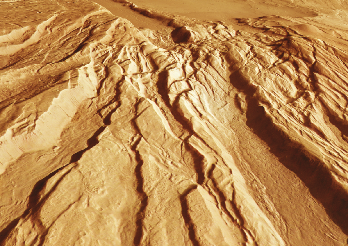
Image data, taken by the High Resolution Stereo Camera (HRSC) on board ESA’s Mars Express mission show the eastern margin of Acheron Fossae, an extensional tectonic graben system located in the northwestern Tharsis region. HRSC is a camera experiment that was developed and is operated by the German Aerospace Center (Deutsches Zentrum für Luft- und Raumfahrt; DLR).
» read more in the main article below...
Acheron Fossae • Position & 3D view
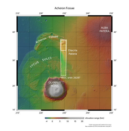
Acheron Fossae - context map
Image Credit: MOLA Science Team/FU Berlin
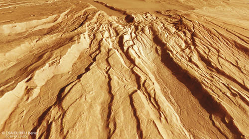
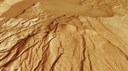
Acheron Fossae - 3D perspective 1
Image Credit: ESA/DLR/FU Berlin
Acheron Fossae - 3D perspective 2
Image Credit: ESA/DLR/FU Berlin
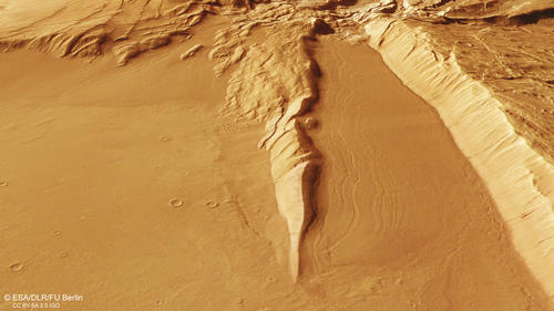
Acheron Fossae - 3D perspective 3
Image Credit: ESA/DLR/FU Berlin
Acheron Fossae • HRSC images
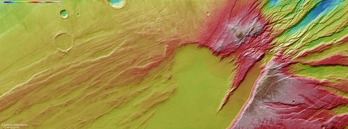
Acheron Fossae - HRSC color-coded terrain model
Image Credit: ESA/DLR/FU Berlin
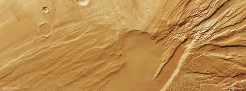
Acheron Fossae - HRSC color image
Image Credit: ESA/DLR/FU Berlin
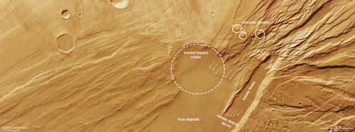
Acheron Fossae - HRSC annotated
Image Credit: ESA/DLR/FU Berlin
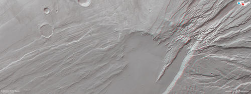
Acheron Fossae - HRSC anaglyph
Image Credit: ESA/DLR/FU Berlin
Glaciers and volcanos in a giant graben system
The Acheron Fossae region is named after Acheron Fossae, an approximately 800 km long tectonic graben system about 1200 km north of Olympus Mons on the outskirts of its aureole. This region appears as a block of ancient terrain surrounded by younger plains in form of a reversed crescent moon on the Martian surface. The HRSC image frames the eastern part of the Acheron Fossae region where the edge of the graben system leads into the lower plains.
The Acheron Fossae graben system has a typical "Horst and Graben" morphology formed by extensional crustal deformation in the Noachian period 3.7-3.9 billion years ago. Several parallel faults (graben) have formed caused by the downward movement of the crust relative to the blocks on either side (horst). These diverging movements of crustal blocks indicate tensional forces in the crust during the time when Mars was more active. During geological evolution the graben have been filled with different material such as glacial and volcanic deposits.
The lower plains show a smooth surface, while the graben system exhibits a rugged and cratered surface. Some of the plains material appears slightly darker and shows only few impact craters. The darker material displays lobate flow-like features (see annotated image). Lobate debris aprons can be spotted around the edges of the grabens. These geomorphological features are indicative of the deposition and movement of volatile-rich material and are thought to represent rock glaciers or debris-covered glaciers while the lobes indicate the flow trend.
The second plains material is slightly lighter in color and shows more impact craters on its surface. Here, the viscous flow pattern is not observed. This deposit is interpreted as lava flows from Alba Patera, one of the large Martian shield volcanoes east of Acheron Fossae that buried the roughly 28 km wide impact crater in the center of the image (see annotated image).
Another intriguing feature found in the HRSC observation is a set of three conical topographic peaks several km in height (see annotated image). These formations are interpreted as volcanic domes created by rift-related volcanism and driven by local magmatic uplift. Partly, the volcanic domes are cut by faults, which could indicate tectonic activity after their formation.
High Resolution Stereo Camera (HRSC)
The images were acquired by the HRSC (High Resolution Stereo Camera) on October 28, 2024 during Mars Express Orbits 26287. The ground resolution is approximately 17 meters per pixel and the image is centered at about 230° East and 36° North. The color image was created using data from the nadir channel, the field of view which is aligned perpendicular to the surface of Mars, and the color channels of the HRSC. The oblique perspective view was generated from the digital terrain model, the nadir and color channels of HRSC. The anaglyph image, which creates a three-dimensional impression of the landscape when viewed with red/blue or red/green glasses, was derived from the nadir channel and one stereo channel. The color-coded topographic view is based on a digital terrain model (DTM) of the region, from which the topography of the landscape can be derived. The reference body for the HRSC-DTM is a Mars equipotential surface (Areoid).
HRSC is a camera experiment that was developed and is operated by the German Aerospace Center (Deutsches Zentrum für Luft- und Raumfahrt; DLR). The systematic processing of the camera data took place at the DLR Institute for Planetary Research in Berlin-Adlershof. The working group of Planetary Science and Remote Sensing at Freie Universität Berlin used the data to create the image products shown here.
To download released raw images and DTMs of the region in GIS-ready formats, follow this link to the mapserver
Images: ESA/DLR/FU Berlin, CC BY-SA 3.0 IGO
Copyright Notice:
Where expressly stated, images are licenced under the Creative Commons Attribution-ShareAlike 3.0 IGO (CC BY-SA 3.0 IGO) licence. The user is allowed to reproduce, distribute, adapt, translate and publicly perform it, without explicit permission, provided that the content is accompanied by an acknowledgement that the source is credited as 'ESA/DLR/FU Berlin', a direct link to the licence text is provided and that it is clearly indicated if changes were made to the original content. Adaptation / translation / derivatives must be distributed under the same licence terms as this publication.
The High Resolution Stereo Camera was developed at the German Aerospace Center (DLR) and built in collaboration with partners in industry (EADS Astrium, Lewicki Microelectronic GmbH and Jena-Optronik GmbH). The science team, which is headed by Principal Investigator (PI) Dr. Daniela Tirsch, consists of 50 co-investigators from 35 institutions and 11 countries. The camera is operated by the DLR Institute of Planetary Research in Berlin-Adlershof.
